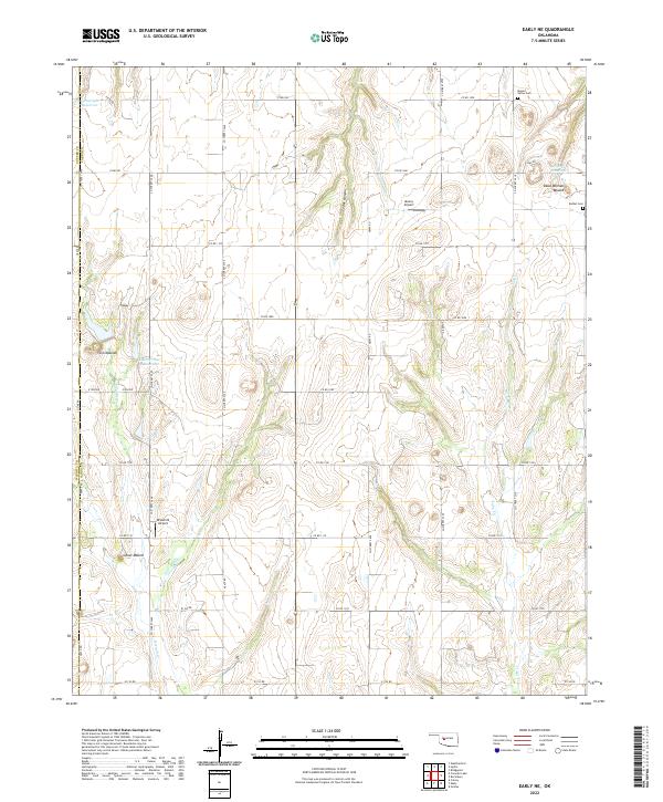
2022 Map of Eakly NE
USGS Topo · Published 2022About this map
Twin Mounds and several other prominent topographical rises define the landscape of this portion of Caddo County, Oklahoma. This modern digital survey reflects a rural environment where land use is split between agriculture and localized water management, evidenced by several catchments like Cartwright Reservoir and Olson Reservoir. The area contains significant historical landmarks for local researchers, including the Mound Valley Cem and Bethel Cem, which mark the centers of early rural communities. The terrain is notably etched by Cedar Canyon and the winding course of Lake Creek. While primarily agricultural, the presence of Muncy Airport and Broken B Airport indicates a reliance on small-scale private aviation in this sparsely populated region where the section line road system, such as Co RD 1080, provides the primary framework for movement.
Find a feature on this map
42 named features on this map. Tap any name to fly to it.
Don’t see what you’re looking for? This feature index may not catch every label — zoom into the map to look around manually.
Map Details
Editions of this 2022 Eakly NE Map
This is the sole edition of this map. No revisions or reprints were ever made.
Other maps of this area

1942 · Geary
USGS Topo · 1:62,500

1951 · Binger
USGS Topo · 1:62,500

1955 · Clinton
USGS Topo · 1:250,000

1957 · Clinton
USGS Topo · 1:250,000

1961 · Eakly
USGS Topo · 1:62,500

1964 · Weatherford
USGS Topo · 1:62,500

1979 · Sickles
USGS Topo · 1:24,000
1979 · Rock Mary
USGS Topo · 1:24,000
1979 · Bridgeport
USGS Topo · 1:24,000

1984 · Eakly
USGS Topo · 1:24,000