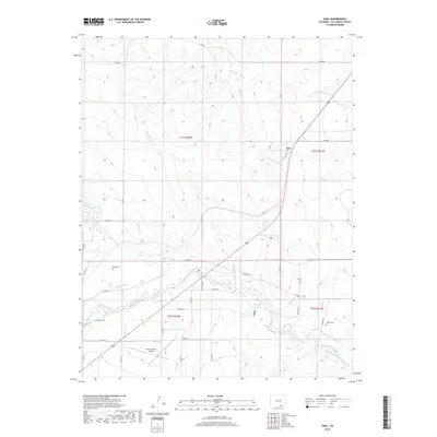
2019 Map of Earl
USGS Topo · Published 2019About this map
The Purgatoire River carves through this portion of Las Animas County, supporting a network of historic irrigation infrastructure essential to high-plains agriculture. Engineers and early settlers developed the Model Ditch, Hoehne Ditch, and Lewelling Mc Cormick Ditch to divert water from the river to nearby farmsteads. These man-made channels contrast with the natural drainages of the Chicosa Arroyo and Blackwell Arroyo that crisscross the landscape.
Find a feature on this map
40 named features on this map. Tap any name to fly to it.
Don’t see what you’re looking for? This feature index may not catch every label — zoom into the map to look around manually.
Map Details
Editions of this 2019 Earl Map
This is the sole edition of this map. No revisions or reprints were ever made.
Other maps of this area

1892 · Elmoro
USGS Topo · 1:125,000

1893 · Elmoro
USGS Topo · 1:125,000

1897 · Elmoro
USGS Topo · 1:125,000

1954 · Trinidad
USGS Topo · 1:250,000

1955 · Trinidad
USGS Topo · 1:250,000

1958 · Trinidad
USGS Topo · 1:250,000

1959 · Trinidad
USGS Topo · 1:250,000
1970 · Earl
USGS Topo · 1:24,000
1970 · Mooney Hills
USGS Topo · 1:24,000
1970 · Hoehne
USGS Topo · 1:24,000