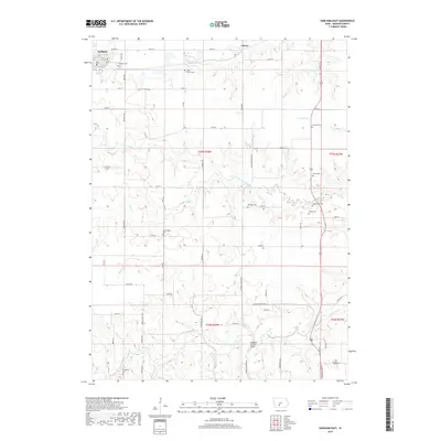
2018 Map of Earlham East
USGS Topo · Published 2018About this map
The Hogback Covered Bridge stands as a primary landmark in this Madison County landscape, spanning the North River just south of Clucas. The terrain is defined by the branching drainages of the North Branch North River and Bulger Cr, which carve a detailed topography across the agricultural heartland. Small clusters of settlement at Earlham and Stringtown anchor the local road network, which follows the section lines of the Public Land Survey System. For genealogists and local historians, the map is particularly rich in burial sites, documenting eight distinct cemeteries including North Branch Cem, Rodabough Cem, and the Worthington Cem. These sites, along with family-named landmarks and historical watercourses like Badger Cr and Tom Cr, provide a clear picture of the rural Iowa community structure as it persisted into the twenty-first century.
Find a feature on this map
42 named features on this map. Tap any name to fly to it.
Don’t see what you’re looking for? This feature index may not catch every label — zoom into the map to look around manually.
Map Details
Editions of this 2018 Earlham East Map
This is the sole edition of this map. No revisions or reprints were ever made.
Other maps of this area

1908 · Waukee
USGS Topo · 1:62,500

1949 · Adel
USGS Topo · 1:62,500

1951 · Adel
USGS Topo · 1:62,500

1951 · St. Charles
USGS Topo · 1:62,500

1952 · Winterset
USGS Topo · 1:62,500

1954 · Omaha
USGS Topo · 1:250,000

1954 · Des Moines
USGS Topo · 1:250,000

1956 · Des Moines
USGS Topo · 1:250,000

1957 · Des Moines
USGS Topo · 1:250,000

1957 · Omaha
USGS Topo · 1:250,000