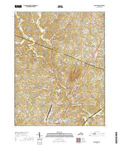
2019 Map of Earlysville
USGS Topo · Published 2019About this map
Advance Mills and Earlysville anchor this rural Piedmont landscape, where the confluence of the Roach River and North Fork Rivanna River historically shaped settlement patterns. The topography transitions from the higher elevations of Frays Mtn and Estes Ridge in the west toward the expanding transportation corridors in the east. The Charlottesville-Albemarle Airport stands as a major modern landmark, contrasted by numerous small family and community burial grounds such as Mount Zion Cem and Estes Cem. These small cemeteries, along with Holly Memorial Gardens, provide valuable touchpoints for genealogical research. The map captures a mix of traditional agriculture and residential growth, with neighborhoods like Hollymead and Piney Mountain situated along the Seminole Trl corridor near the Greene Co and Albemarle Co border.
Find a feature on this map
193 named features on this map. Tap any name to fly to it.
Don’t see what you’re looking for? This feature index may not catch every label — zoom into the map to look around manually.
Map Details
Editions of this 2019 Earlysville Map
This is the sole edition of this map. No revisions or reprints were ever made.
Other maps of this area

1892 · Gordonsville
USGS Topo · 1:125,000

1892 · Harrisonburg
USGS Topo · 1:125,000

1930 · Madison
USGS Topo · 1:48,000

1931 · University
USGS Topo · 1:62,500

1933 · Madison
USGS Topo · 1:62,500

1935 · Charlottesville
USGS Topo · 1:62,500

1935 · University
USGS Topo · 1:62,500

1937 · Elkton
USGS Topo · 1:62,500

1939 · Charlottesville
USGS Topo · 1:62,500

1949 · Charlottesville
USGS Topo · 1:250,000