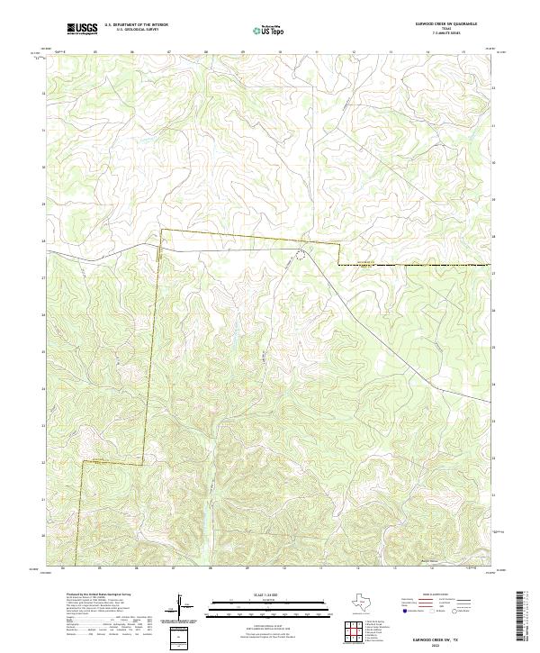
2022 Map of Earwood Creek SW
USGS Topo · Published 2022About this map
The E Prong Nueces River carves through the Edwards Plateau in this section of Southwest Texas, defining a landscape of sharp relief and seasonal drainages. The map captures the boundary between Edwards and Real County, where the terrain is dominated by deep canyons and high ridges typical of the Hill Country's western edge. Local watercourses like Contrary Cr and Hunger Cr feed into the larger river system, while named features such as Ranger Hollow reflect the traditional nomenclature of the region's ranching and hunting heritage. Rural access is primarily provided by Hackberry Rd and Fairview Rd, which navigate the winding topography. This survey provides a clear view of the land's natural drainage patterns and the sparse network of secondary roads that connect remote properties.
Find a feature on this map
12 named features on this map. Tap any name to fly to it.
Don’t see what you’re looking for? This feature index may not catch every label — zoom into the map to look around manually.
Map Details
Editions of this 2022 Earwood Creek SW Map
This is the sole edition of this map. No revisions or reprints were ever made.
Other maps of this area

1893 · Rock Springs
USGS Topo · 1:125,000

1893 · Nueces
USGS Topo · 1:125,000

1896 · Nueces
USGS Topo · 1:125,000

1947 · Hackberry
USGS Topo · 1:62,500

1954 · Llano
USGS Topo · 1:250,000

1954 · San Antonio
USGS Topo · 1:250,000

1954 · Sonora
USGS Topo · 1:250,000

1955 · Llano
USGS Topo · 1:250,000

1956 · Llano
USGS Topo · 1:250,000

1957 · San Antonio
USGS Topo · 1:250,000