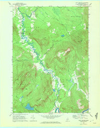
1968 Map of East Andover
USGS Topo · Published 1972About this map
South Andover and East Andover anchor the valley of the West Br Ellis River in this late-1960s survey of Oxford County. The landscape is defined by the tight relationship between the river's meandering course and the steep elevations of Whitecap Mtn and Plumbago Mountain. This period shows a transition from traditional rural infrastructure, like the Covered Bridge near a Gaging Sta, toward modern additions such as Farrington Airport. For family historians, the map is particularly useful for its density of burial sites, including the Woodlawn Cem, Farmers Hill Cem, and several riverside locations like the Upper West Ellis Cem. Industry is represented by several scattered Quarries and a Gravel Pit near Davis Pond, while the southern edge follows the significant curve of the Androscoggin River at Rumford Point.
Find a feature on this map
41 named features on this map. Tap any name to fly to it.
Don’t see what you’re looking for? This feature index may not catch every label — zoom into the map to look around manually.
Map Details
Editions of this 1968 East Andover Map
3 editions found
Other maps of this area

1911 · Bryant Pond
USGS Topo · 1:62,500

1914 · Bethel
USGS Topo · 1:62,500

1914 · Bryant Pond
USGS Topo · 1:62,500

1927 · Rumford
USGS Topo · 1:48,000

1930 · Rumford
USGS Topo · 1:62,500

1940 · Bethel
USGS Topo · 1:62,500

1941 · Bethel
USGS Topo · 1:62,500

1942 · Bryant Pond
USGS Topo · 1:62,500

1943 · Old Speck Mtn
USGS Topo · 1:62,500

1945 · Old Speck Mtn
USGS Topo · 1:62,500