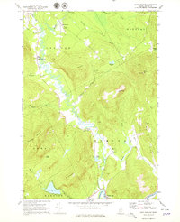
1968 Map of East Andover
USGS Topo · Published 1979About this map
The Ellis River corridor defines the geography of this Oxford County landscape, where the valley floor transitions from agricultural tracts into the steep rising slopes of the Mahoosuc Range. Near the settlement of South Andover, a historic Covered Bridge and Gaging Sta mark the river's crossing, while the nearby Farrington Airport serves the small community of East Andover. This 1968 field-checked survey documents a rural economy rooted in land management, indicated by numerous Quarries and a Quarry near Split Red Hill Brook. Genealogists will find several burial grounds distributed among the family farms, including Farmers Hill Cem and a cluster of three cemeteries—Upper West Ellis Cem, Lower West Ellis Cem, and East Ellis Cem—near the confluence with the Androscoggin River at Rumford Point.
Find a feature on this map
41 named features on this map. Tap any name to fly to it.
Don’t see what you’re looking for? This feature index may not catch every label — zoom into the map to look around manually.
Map Details
Editions of this 1968 East Andover Map
3 editions found
Other maps of this area

1911 · Bryant Pond
USGS Topo · 1:62,500

1914 · Bethel
USGS Topo · 1:62,500

1914 · Bryant Pond
USGS Topo · 1:62,500

1927 · Rumford
USGS Topo · 1:48,000

1930 · Rumford
USGS Topo · 1:62,500

1940 · Bethel
USGS Topo · 1:62,500

1941 · Bethel
USGS Topo · 1:62,500

1942 · Bryant Pond
USGS Topo · 1:62,500

1943 · Old Speck Mtn
USGS Topo · 1:62,500

1945 · Old Speck Mtn
USGS Topo · 1:62,500