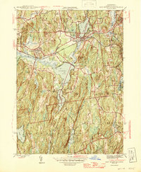
1946 Map of East Brookfield
USGS Topo · Published 1946About this map
The Quaboag River and its expansive wetlands anchor this 1946 survey, illustrating a central Massachusetts landscape defined by glacial ponds and a transit-oriented industrial spine. The Boston and Albany RR cuts across the northern half of the sheet, connecting the manufacturing centers of Brookfield, East Brookfield, and Spencer. This rail corridor mirrors the natural drainage of the Sevenmile River and the East Brookfield River, which feed into the large basins of Lake Lashaway and Quaboag Pond. These water bodies provided both power and aesthetic value to the surrounding towns as they transitioned from agricultural foundations to manufacturing hubs.
Find a feature on this map
55 named features on this map. Tap any name to fly to it.
Don’t see what you’re looking for? This feature index may not catch every label — zoom into the map to look around manually.
Map Details
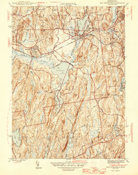
Editions of this 1946 East Brookfield Map
2 editions found
Other maps of this area

1885 · Worcester
USGS Topo · 1:62,500

1886 · Worcester
USGS Topo · 1:62,500

1887 · Brookfield
USGS Topo · 1:62,500

1887 · Barre
USGS Topo · 1:62,500

1889 · Webster
USGS Topo · 1:62,500

1889 · Barre
USGS Topo · 1:62,500

1890 · Brookfield
USGS Topo · 1:62,500

1892 · Webster
USGS Topo · 1:62,500

1892 · Worcester
USGS Topo · 1:62,500

1893 · Brookfield
USGS Topo · 1:62,500