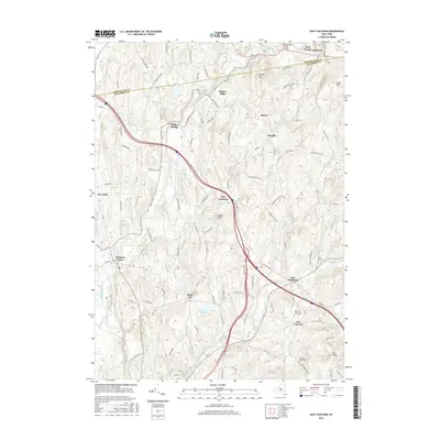
2016 Map of East Chatham
USGS Topo · Published 2016About this map
Kinderhook Creek winds through this landscape, defining the corridor for historic hamlets and road networks along the border of Columbia and Rensselaer counties. The settlement pattern is characterized by scattered small villages such as Malden Bridge and Riders Mills in the north, transitioning into the larger crossroads of Old Chatham and East Chatham further south. The presence of multiple cemeteries, including Mountain View Cem and the Lovejoy-Beebe Cem, offers specific points of interest for genealogical research within these established rural communities. Elevation varies significantly across the quadrangle, from the prominent Ashley Hill and Gale Hill in the northeast to the distinctive Tonys Nose and The Knobit to the south. These landforms, alongside water bodies like Sutherland Pond and Bachus Pond, shaped the early agricultural and mill-based economy of the region.
Find a feature on this map
109 named features on this map. Tap any name to fly to it.
Don’t see what you’re looking for? This feature index may not catch every label — zoom into the map to look around manually.
Map Details
Editions of this 2016 East Chatham Map
This is the sole edition of this map. No revisions or reprints were ever made.
Other maps of this area

1888 · Berlin
USGS Topo · 1:62,500

1888 · Pittsfield
USGS Topo · 1:62,500

1890 · Pittsfield
USGS Topo · 1:62,500

1890 · Berlin
USGS Topo · 1:62,500

1893 · Troy
USGS Topo · 1:62,500

1893 · Pittsfield
USGS Topo · 1:62,500

1894 · Berlin
USGS Topo · 1:62,500

1894 · Pittsfield
USGS Topo · 1:62,500

1895 · Troy
USGS Topo · 1:62,500

1897 · Pittsfield
USGS Topo · 1:62,500