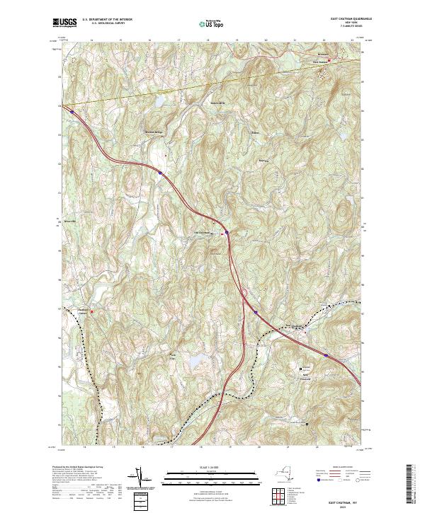
2023 Map of East Chatham
USGS Topo · Published 2023About this map
Kinderhook Creek and the Stony Kill define the topography of this corner of Columbia and Rensselaer Counties, where a network of hamlets and rural crossroads remains remarkably intact. The map detail highlights the historic development of East Chatham and Old Chatham, which grew along the waterway and early road systems. The presence of Riders Mills and Malden Bridge points to a landscape historically centered on small-scale milling and valley agriculture.
Find a feature on this map
108 named features on this map. Tap any name to fly to it.
Don’t see what you’re looking for? This feature index may not catch every label — zoom into the map to look around manually.
Map Details
Editions of this 2023 East Chatham Map
This is the sole edition of this map. No revisions or reprints were ever made.
Other maps of this area

1888 · Berlin
USGS Topo · 1:62,500

1888 · Pittsfield
USGS Topo · 1:62,500

1890 · Pittsfield
USGS Topo · 1:62,500

1890 · Berlin
USGS Topo · 1:62,500

1893 · Troy
USGS Topo · 1:62,500

1893 · Pittsfield
USGS Topo · 1:62,500

1894 · Berlin
USGS Topo · 1:62,500

1894 · Pittsfield
USGS Topo · 1:62,500

1895 · Troy
USGS Topo · 1:62,500

1897 · Pittsfield
USGS Topo · 1:62,500