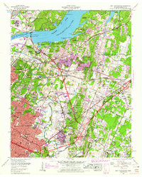
1958 Map of East Chattanooga
USGS Topo · Published 1959About this map
Chickamauga Dam anchors this mid-century landscape where the Tennessee River widens into the expansive Chickamauga Lake. The area reflects a period of intense post-war development and infrastructure, visible in the sprawling Volunteer Ordnance Works and the growing aviation hub at Chattanooga Municipal Airport (Lovell Field). Along the geological spine of Missionary Ridge, residential growth pushes into established neighborhoods like Brainerd and Eastdale, while the Southern Railway and Louisville and Nashville Railroad continue to define the industrial corridors. Family history is well-documented through numerous small burial sites such as Smith Cem, Hancock Cem, and the Silverdale Cem. The transition from rural to suburban is captured in the scattered schools like Bess T Shepherd Sch and the lakeside recreation found at Booker T Washington State Park.
Find a feature on this map
80 named features on this map. Tap any name to fly to it.
Don’t see what you’re looking for? This feature index may not catch every label — zoom into the map to look around manually.
Map Details
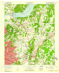
Editions of this 1958 East Chattanooga Map
2 editions found
Other maps of this area

1886 · Ringgold
USGS Topo · 1:125,000

1888 · Chattanooga
USGS Topo · 1:125,000

1892 · Ringgold
USGS Topo · 1:125,000

1893 · Chattanooga
USGS Topo · 1:125,000

1935 · East Chattanooga
USGS Topo · 1:24,000

1935 · Daisy
USGS Topo · 1:24,000

1935 · East Ridge
USGS Topo · 1:24,000

1935 · Ringgold
USGS Topo · 1:24,000

1935 · Snow Hill
USGS Topo · 1:24,000

1935 · Ooltewah
USGS Topo · 1:24,000
Featured Places
- Chattanooga, TN
- East Ridge, TN
- Rollingwood, Chattanooga
- Kings Point, Chattanooga
- Cherokee Woods, Chattanooga