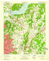
1958 Map of East Chattanooga
USGS Topo · Published 1968About this map
Chickamauga Dam anchors the landscape of this late 1950s survey, marking the transition from the Tennessee River to the broad waters of Chickamauga Lake. The area shows a period of significant mid-century expansion, where the urban footprint of Chattanooga and suburbs like Brainerd and Eastdale push eastward toward the massive Volunteer Ordnance Works. This military presence, combined with the Chattanooga Municipal Airport (Lovell Field), underscores the region's strategic and industrial importance during the Cold War era.
Find a feature on this map
98 named features on this map. Tap any name to fly to it.
Don’t see what you’re looking for? This feature index may not catch every label — zoom into the map to look around manually.
Map Details
Editions of this 1958 East Chattanooga Map
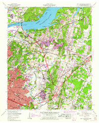
2 editions found
Other maps of this area

1886 · Ringgold
USGS Topo · 1:125,000

1888 · Chattanooga
USGS Topo · 1:125,000

1892 · Ringgold
USGS Topo · 1:125,000

1893 · Chattanooga
USGS Topo · 1:125,000

1935 · East Chattanooga
USGS Topo · 1:24,000

1935 · Daisy
USGS Topo · 1:24,000

1935 · East Ridge
USGS Topo · 1:24,000

1935 · Ringgold
USGS Topo · 1:24,000

1935 · Snow Hill
USGS Topo · 1:24,000

1935 · Ooltewah
USGS Topo · 1:24,000
Featured Places
- Chattanooga, TN
- East Ridge, TN
- Rollingwood, Chattanooga
- Kings Point, Chattanooga
- Cherokee Woods, Chattanooga