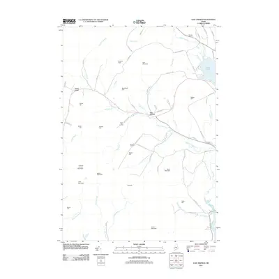
2011 Map of East Dixfield
USGS Topo · Published 2011About this map
East Dixfield serves as the central hub of this Franklin County landscape, where the meandering course of Sevenmile Stream meets a network of local roads including Adams Rd and Science Hill Rd. The terrain is defined by a series of prominent rises such as Law Mountain, Butterfield Hill, and Canton Mountain, reflecting the upland character of the western Maine foothills. For genealogists, the map is particularly useful for locating several distinct burial sites, including Science Hill Cemetery, Severy Hill Cemetery, and Birchland Cemetery near the stream. The northeastern corner is dominated by the waters of Wilson Pond, while the southern reaches descend toward the Androscoggin River. Small settlements and historic junctions like Tainter Corner and the heights of Colonel Holman Mountain provide specific landmarks for those tracing family property and local migration patterns through this part of Jay and its surroundings.
Find a feature on this map
72 named features on this map. Tap any name to fly to it.
Don’t see what you’re looking for? This feature index may not catch every label — zoom into the map to look around manually.
Map Details
Editions of this 2011 East Dixfield Map
This is the sole edition of this map. No revisions or reprints were ever made.
Other maps of this area

1910 · Livermore
USGS Topo · 1:62,500

1911 · Buckfield
USGS Topo · 1:62,500

1912 · Livermore
USGS Topo · 1:62,500

1913 · Buckfield
USGS Topo · 1:62,500

1924 · Farmington
USGS Topo · 1:62,500

1926 · Dixfield
USGS Topo · 1:62,500

1929 · Dixfield
USGS Topo · 1:62,500

1941 · Livermore
USGS Topo · 1:62,500

1942 · Buckfield
USGS Topo · 1:62,500

1950 · Lewiston
USGS Topo · 1:250,000