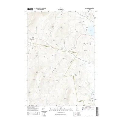
2014 Map of East Dixfield
USGS Topo · Published 2014About this map
East Dixfield and Tainter Corner sit at the intersection of rural life and natural topography along the boundary between Franklin and Oxford counties. In this 2014 survey, the landscape is defined by its numerous family-named peaks and hills, such as Colonel Holman Mountain, Science Hill, and Gould Hill. The drainage patterns of Sevenmile Stream and its tributaries like Butterfield Brook and Potash Brook dictate the placement of roads and early settlements.
Find a feature on this map
88 named features on this map. Tap any name to fly to it.
Don’t see what you’re looking for? This feature index may not catch every label — zoom into the map to look around manually.
Map Details
Editions of this 2014 East Dixfield Map
This is the sole edition of this map. No revisions or reprints were ever made.
Other maps of this area
1910 · Livermore
USGS Topo · 1:62,500
1911 · Buckfield
USGS Topo · 1:62,500
1912 · Livermore
USGS Topo · 1:62,500
1913 · Buckfield
USGS Topo · 1:62,500
1924 · Farmington
USGS Topo · 1:62,500
1926 · Dixfield
USGS Topo · 1:62,500
1929 · Dixfield
USGS Topo · 1:62,500
1941 · Livermore
USGS Topo · 1:62,500
1942 · Buckfield
USGS Topo · 1:62,500
1950 · Lewiston
USGS Topo · 1:250,000