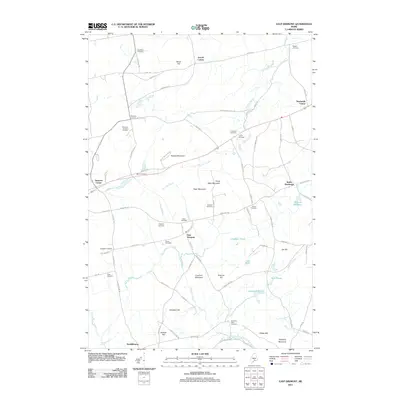
2011 Map of East Dixmont
USGS Topo · Published 2011About this map
East Dixmont and surrounding crossroads hamlets like Simpson Corners and Dixmont Center define this section of the Maine interior during the early 21st century. The landscape is characterized by a high density of small family and community burial grounds, including the Monk Cemetery, Harmony Place Cemetery, and Porter Cemetery, reflecting the long-established settlement patterns of Waldo and Penobscot Counties. A network of local roads such as Red School House Rd and Town Farm Rd connect these rural clusters across a terrain of modest peaks and wetlands. Prominent elevations like Croxford Mountain and Peaked Mountain rise above water bodies like Chapman Pond and Northern Pond, while Gilmore Meadows suggests the low-lying drainage basins that feed into the North Branch Marsh Stream.
Find a feature on this map
84 named features on this map. Tap any name to fly to it.
Don’t see what you’re looking for? This feature index may not catch every label — zoom into the map to look around manually.
Map Details
Editions of this 2011 East Dixmont Map
This is the sole edition of this map. No revisions or reprints were ever made.
Other maps of this area

1900 · Bucksport
USGS Topo · 1:62,500

1902 · Bucksport
USGS Topo · 1:62,500

1902 · Bangor
USGS Topo · 1:62,500

1931 · Stetson
USGS Topo · 1:48,000

1932 · Brooks
USGS Topo · 1:62,500

1935 · Stetson
USGS Topo · 1:62,500

1942 · Bangor
USGS Topo · 1:62,500

1942 · Bucksport
USGS Topo · 1:62,500

1946 · Bangor
USGS Topo · 1:62,500

1948 · Bangor
USGS Topo · 1:250,000