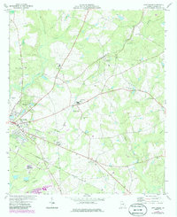
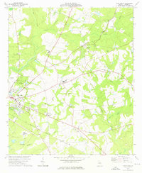
1974 Map of East Dublin
USGS Topo · Published 1986About this map
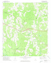
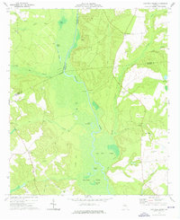
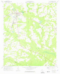
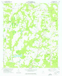
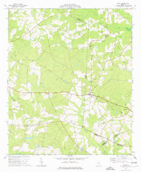
Central of Georgia and Seaboard Coast Line rail corridors converge as they approach the Oconee River, shaping the rural landscape around East Dublin. The area reflects a mid-1970s balance of agricultural tradition and industrial utility, characterized by a dense network of country churches and schools. Local heritage is deeply rooted in landmarks like the Brewton Grave and Zion Hill Ch, while the presence of the East Dublin Drive-in Theater and Josey Academy captures the mid-century social character of the community. In the southern portion of the sheet, the industrial landscape is defined by the Industrial Waste Pond and Shaddock Creek, contrasting with the more traditional settlement patterns of Brewton and Condor. Further east, the terrain is marked by family-named landmarks and cemeteries like the New Evergreen Ch Cem, providing significant detail for those tracing local lineages.
Find a feature on this map
40 named features on this map. Tap any name to fly to it.
Don’t see what you’re looking for? This feature index may not catch every label — zoom into the map to look around manually.
Map Details
Editions of this 1974 East Dublin Map
2 editions found
Other maps of this area

1957 · Macon
USGS Topo · 1:250,000

1958 · Macon
USGS Topo · 1:250,000

1964 · Macon
USGS Topo · 1:250,000
1971 · Rockledge
USGS Topo · 1:24,000
1974 · Cow Hell Swamp
USGS Topo · 1:24,000
1974 · Wrightsville
USGS Topo · 1:24,000

1974 · Rentz
USGS Topo · 1:24,000
1974 · East Dublin
USGS Topo · 1:24,000
1974 · Lovett
USGS Topo · 1:24,000
1974 · Scott
USGS Topo · 1:24,000