
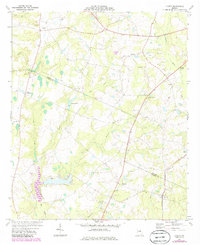
1974 Map of Lovett
USGS Topo · Published 1976About this map
The Central of Georgia railroad cuts through the southeastern corner of Johnson County, anchoring the rural crossroads of Lovett and the nearby community of Midway. This mid-1970s landscape is characterized by a dense network of country churches, such as Buckeye Ch and Arline Ch, which often serve as the primary landmarks for local families and genealogists. The topography is defined by the winding course of the Ohoopee River and the significant drainage of Big Creek, where Jackson Pond provides a localized water feature amid the timbered terrain. Further north, Tuckers Crossroads marks a key intersection, while smaller family landmarks like Williams Cem and Mason Spring are scattered across the agrarian landscape. The map also captures specialized infrastructure of the era, including a Landing Strip and a power Substation, reflecting the slow modernization of this traditionally rural section of the Georgia coastal plain.
Find a feature on this map
26 named features on this map. Tap any name to fly to it.
Don’t see what you’re looking for? This feature index may not catch every label — zoom into the map to look around manually.
Map Details
Editions of this 1974 Lovett Map
2 editions found
Other maps of this area

1957 · Macon
USGS Topo · 1:250,000

1958 · Macon
USGS Topo · 1:250,000

1962 · Oconee
USGS Topo · 1:24,000

1962 · Irwins Crossroads
USGS Topo · 1:24,000

1964 · Macon
USGS Topo · 1:250,000
1973 · Harrison
USGS Topo · 1:24,000

1974 · Cow Hell Swamp
USGS Topo · 1:24,000

1974 · Wrightsville
USGS Topo · 1:24,000

1974 · East Dublin
USGS Topo · 1:24,000

1974 · Scott
USGS Topo · 1:24,000