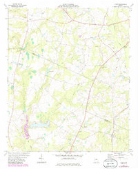
1974 Map of Lovett
USGS Topo · Published 1986About this map
The Central Of Georgia railroad cuts through the eastern half of this terrain, serving rural communities like Lovett and Spann as it follows the ridge line. This mid-1970s landscape, crossing the boundary of Johnson and Laurens counties, is defined by a dense network of small rural congregations and family landmarks. Numerous churches, including Iver Ch, Buckeye Ch, New Bethel Ch, and Mt Pullen Ch, are scattered along the dirt and light-duty roads, often adjacent to cemeteries like Williams Cem. The drainage patterns of Big Creek and the Ohoopee River shape the agricultural layout, while smaller features such as Jackson Pond and Mason Spring provide local water sources. At Tuckers Crossroad, the map reveals the intersection of early transit paths that anchored this Georgia community during the late twentieth century.
Find a feature on this map
29 named features on this map. Tap any name to fly to it.
Don’t see what you’re looking for? This feature index may not catch every label — zoom into the map to look around manually.
Map Details
Editions of this 1974 Lovett Map
2 editions found
Other maps of this area

1957 · Macon
USGS Topo · 1:250,000

1958 · Macon
USGS Topo · 1:250,000

1962 · Oconee
USGS Topo · 1:24,000

1962 · Irwins Crossroads
USGS Topo · 1:24,000

1964 · Macon
USGS Topo · 1:250,000
1973 · Harrison
USGS Topo · 1:24,000

1974 · Cow Hell Swamp
USGS Topo · 1:24,000

1974 · Wrightsville
USGS Topo · 1:24,000

1974 · East Dublin
USGS Topo · 1:24,000

1974 · Lovett
USGS Topo · 1:24,000