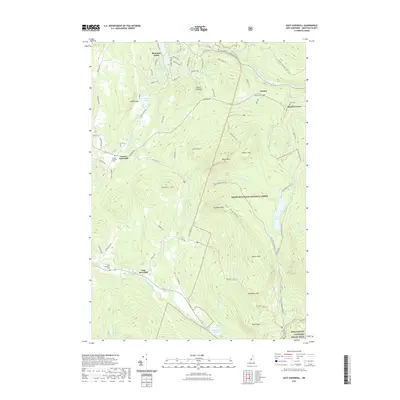
2021 Map of East Haverhill
USGS Topo · Published 2021About this map
The Wild Ammonoosuc River carves through the northern reaches of this Grafton County landscape, where the foothills of the White Mountain National Forest define the eastern terrain. Small settlements and local landmarks like Boutin Corner and Mountain Lakes are connected by a network of winding mountain roads such as Bradley Hill Rd and Wild Ammonoosuc Rd. The area is marked by significant topographical features, including Black Mtn and Sugarloaf Mtn, which overlook numerous small water bodies like French Pond and Oliverian Pond.
Find a feature on this map
79 named features on this map. Tap any name to fly to it.
Don’t see what you’re looking for? This feature index may not catch every label — zoom into the map to look around manually.
Map Details
Editions of this 2021 East Haverhill Map
This is the sole edition of this map. No revisions or reprints were ever made.
Other maps of this area

1928 · Rumney
USGS Topo · 1:62,500

1929 · Moosilauke
USGS Topo · 1:62,500

1931 · Mt. Cube
USGS Topo · 1:62,500

1931 · Woodsville
USGS Topo · 1:48,000

1932 · Rumney
USGS Topo · 1:62,500

1932 · Moosilauke
USGS Topo · 1:62,500

1933 · Mt. Cube
USGS Topo · 1:62,500

1935 · Woodsville
USGS Topo · 1:62,500

1941 · Woodsville
USGS Topo · 1:62,500

1949 · Portland
USGS Topo · 1:250,000