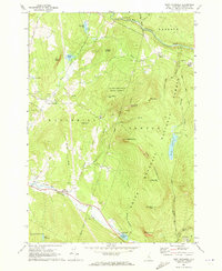
1967 Map of East Haverhill
USGS Topo · Published 1973About this map
The White Mountain National Forest dominates the eastern half of this landscape, where the massive profile of Black Mountain and The Hogsback rise sharply above the river valleys. In the late 1960s, this region of Grafton County maintained a rural character centered around small crossroads such as Benton and Boutin Corner. The presence of the Glencliff State Sanatorium in the south and the Black Mtn Lookout Tower reflects the area's dual history of public health institutions and forestry management. Water defines the boundaries of travel, with the Wild Ammonoosuc River cutting through the northern reaches near Bath and Landaff. Transport routes like Benton Road and North South Road follow the natural contours of the land, while the Old Railroad Grade passing through East Haverhill provides a tangible link to the era of steam and timber extraction. Scattered family cemeteries, including Benton Cem and East Cem, offer specific points of interest for those tracing local lineages.
Find a feature on this map
61 named features on this map. Tap any name to fly to it.
Don’t see what you’re looking for? This feature index may not catch every label — zoom into the map to look around manually.
Map Details
Editions of this 1967 East Haverhill Map
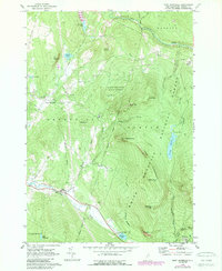
2 editions found
Other maps of this area

1928 · Rumney
USGS Topo · 1:62,500

1929 · Moosilauke
USGS Topo · 1:62,500

1931 · Mt. Cube
USGS Topo · 1:62,500

1931 · Woodsville
USGS Topo · 1:48,000

1932 · Rumney
USGS Topo · 1:62,500

1932 · Moosilauke
USGS Topo · 1:62,500

1933 · Mt. Cube
USGS Topo · 1:62,500

1935 · Woodsville
USGS Topo · 1:62,500

1941 · Woodsville
USGS Topo · 1:62,500

1949 · Portland
USGS Topo · 1:250,000