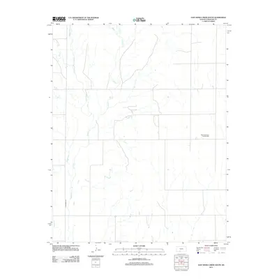
2012 Map of East Kiowa Creek South
USGS Topo · Published 2012About this map
Comanche County, Kansas, is defined here by the intricate drainage of the Kiowa Creek system, where several major branches converge. The landscape is structured around the paths of Middle Kiowa Cr, W Kiowa Cr, and E Kiowa Cr, which draw water from the surrounding prairie towards the main thread of Kiowa Cr. These waterways dictate the positioning of the region's sparse infrastructure, with section-line roads and local thoroughfares like N Broadway Ave navigating the terrain. A notable private landmark in this rural expanse is the Seacat Brothers Landing Strip, situated in the eastern portion of the quadrangle. Other minor tributaries, including Wiggins Cr and Buzzard Cr, further carve the land, reflecting the typical hydrological patterns of the High Plains prior to the modern era of intense agricultural modification.
Find a feature on this map
8 named features on this map. Tap any name to fly to it.
Don’t see what you’re looking for? This feature index may not catch every label — zoom into the map to look around manually.
Map Details
Editions of this 2012 East Kiowa Creek South Map
This is the sole edition of this map. No revisions or reprints were ever made.
Other maps of this area

1892 · Coldwater
USGS Topo · 1:125,000

1894 · Sitka
USGS Topo · 1:62,500

1896 · Ashland
USGS Topo · 1:125,000

1955 · Pratt
USGS Topo · 1:250,000

1959 · Pratt
USGS Topo · 1:250,000

1979 · Sugarloaf
USGS Topo · 1:24,000

1979 · Turkey Creek
USGS Topo · 1:24,000

1979 · Coldwater
USGS Topo · 1:24,000

1979 · East Kiowa Creek South
USGS Topo · 1:24,000
1979 · East Kiowa Creek North
USGS Topo · 1:24,000