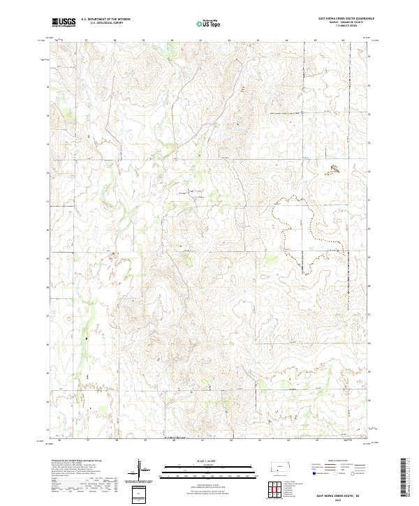
2022 Map of East Kiowa Creek South
USGS Topo · Published 2022About this map
The northern reaches of the Kiowa Cr drainage system define this portion of Comanche County, where a network of seasonal streams carves through the Kansas plains. This landscape is dominated by the confluence and various branches of the local waterways, including Middle Kiowa Cr, W Kiowa Cr, and E Kiowa Cr. Farther north, Wiggins Cr feeds into the system, while Buzzard Cr appears in the southwestern corner, illustrating the complex hydrography that has shaped ranching and land use in the region for generations.
Find a feature on this map
30 named features on this map. Tap any name to fly to it.
Don’t see what you’re looking for? This feature index may not catch every label — zoom into the map to look around manually.
Map Details
Editions of this 2022 East Kiowa Creek South Map
This is the sole edition of this map. No revisions or reprints were ever made.
Other maps of this area

1892 · Coldwater
USGS Topo · 1:125,000

1894 · Sitka
USGS Topo · 1:62,500

1896 · Ashland
USGS Topo · 1:125,000

1955 · Pratt
USGS Topo · 1:250,000

1959 · Pratt
USGS Topo · 1:250,000

1979 · Sugarloaf
USGS Topo · 1:24,000

1979 · Turkey Creek
USGS Topo · 1:24,000

1979 · Coldwater
USGS Topo · 1:24,000

1979 · East Kiowa Creek South
USGS Topo · 1:24,000
1979 · East Kiowa Creek North
USGS Topo · 1:24,000