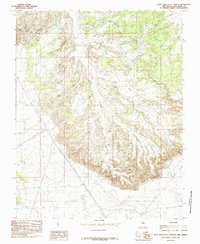
1985 Map of East Kutz Canyon
USGS Topo · Published 1985About this map
The Navajo Indian Irrigation Project Main Canal cuts through the northern landscape of this San Juan County quadrant, representing a significant mid-to-late 20th-century water engineering project designed to transform the arid terrain. The map is dominated by the intricate erosional patterns of Kutz Canyon, where the West Fork and East Fork converge amidst a network of smaller draws and mesas. This 1985 provisional edition reveals an industrial overlay on the natural topography, marked by numerous gas wells indicated by the GW labels scattered across the plateaus and canyon floors. This density of energy extraction points, alongside a prominent north-south Pipeline and a Transmission Line, documents the region's role as a major energy production hub in the Four Corners area during the 1980s.
Find a feature on this map
7 named features on this map. Tap any name to fly to it.
Don’t see what you’re looking for? This feature index may not catch every label — zoom into the map to look around manually.
Map Details
Editions of this 1985 East Kutz Canyon Map
This is the sole edition of this map. No revisions or reprints were ever made.
Other maps of this area

1889 · Largo
USGS Topo · 1:250,000

1889 · Chaco
USGS Topo · 1:250,000

1892 · Chaco
USGS Topo · 1:250,000

1895 · Largo
USGS Topo · 1:250,000

1954 · Shiprock
USGS Topo · 1:250,000

1954 · Aztec
USGS Topo · 1:250,000

1958 · Shiprock
USGS Topo · 1:250,000

1958 · Aztec
USGS Topo · 1:250,000

1959 · Shiprock
USGS Topo · 1:250,000

1960 · Bloomfield
USGS Topo · 1:62,500