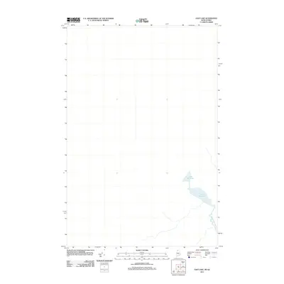
2011 Map of East Lake
USGS Topo · Published 2011About this map
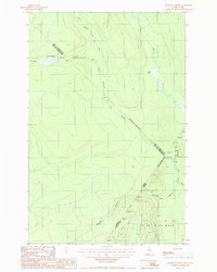
Little East Lake sits at the heart of this wilderness landscape on the border of Maine and Quebec, according to this 2011 survey. The terrain is defined by its hydrology, where the lake serves as a primary feature in a remote section of the Maine North Woods. The southern portion of the sheet shows the winding path of Chimenticook Stream, which drains the surrounding basin. This topographic record captures the area as it appeared in the early 21st century, showing a region largely devoid of significant human settlement or developed road networks. The layout of the waterways here highlights the natural drainage patterns that have historically dictated travel and logging activity in this northern borderland.
Find a feature on this map
2 named features on this map. Tap any name to fly to it.
Don’t see what you’re looking for? This feature index may not catch every label — zoom into the map to look around manually.
Map Details
Editions of this 2011 East Lake Map
This is the sole edition of this map. No revisions or reprints were ever made.
Other maps of this area

1955 · Rocky Mountain
USGS Topo · 1:62,500

1955 · Little East Lake
USGS Topo · 1:62,500

1955 · Rocky Brook
USGS Topo · 1:62,500

1962 · Edmundston
USGS Topo · 1:250,000

1976 · East Lake
USGS Topo · 1:24,000

1976 · East Lake SE
USGS Topo · 1:24,000
1977 · St. Omer
USGS Topo · 1:24,000
1987 · Rocky Mountain SW
USGS Topo · 1:24,000
1987 · St. Omer
USGS Topo · 1:24,000
1987 · Morrison Brook
USGS Topo · 1:24,000