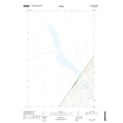
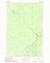
2018 Map of East Lake
USGS Topo · Published 2018About this map
The international border between Canada and the United States bisects this remote reach of the Maine north woods, where the landscape is defined by vast waterways and the Saint John River watershed. The prominent East Lake stretches across the boundary, its waters shared by both nations in a region largely dominated by timberlands and hydrological features. On the American side, Little East Lake sits tucked into the southeastern corner, feeding into the Chimenticook Stream which meanders through the dense forest. Access to this isolated terrain is limited, primarily represented by E Lake Rd, which skirts the eastern shoreline of the lakes. To the north, the Ruisseau Pocwock flows through the Canadian territory, illustrating the trans-border nature of the drainage patterns in this wild, high-altitude corridor of Aroostook County.
Find a feature on this map
6 named features on this map. Tap any name to fly to it.
Don’t see what you’re looking for? This feature index may not catch every label — zoom into the map to look around manually.
Map Details
Editions of this 2018 East Lake Map
This is the sole edition of this map. No revisions or reprints were ever made.
Other maps of this area

1955 · Rocky Mountain
USGS Topo · 1:62,500

1955 · Little East Lake
USGS Topo · 1:62,500

1955 · Rocky Brook
USGS Topo · 1:62,500

1962 · Edmundston
USGS Topo · 1:250,000

1976 · East Lake
USGS Topo · 1:24,000

1976 · East Lake SE
USGS Topo · 1:24,000
1977 · St. Omer
USGS Topo · 1:24,000
1987 · Rocky Mountain SW
USGS Topo · 1:24,000
1987 · St. Omer
USGS Topo · 1:24,000
1987 · Morrison Brook
USGS Topo · 1:24,000