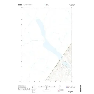
2021 Map of East Lake
USGS Topo · Published 2021About this map
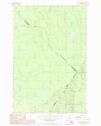
Canada and the United States meet at a sharp diagonal boundary in this northern wilderness, where the remote landscape is dominated by large bodies of water and seasonal streams. The expansive East Lake stretches across the international line, while its smaller companion, Little East Lake, sits entirely within the American side, surrounded by marshy wetlands. This region is defined by its lack of dense development, with only the unpaved E Lake Rd providing access to the shore. Natural drainage is managed by the Pocwock Stream and Chimenticook Stream, which flow through the timberlands of Aroostook County. The map provides an essential view of the geopolitical boundary as it was recorded in 2021, showing how the natural hydrography of the North Woods ignores human-drawn borders.
Find a feature on this map
6 named features on this map. Tap any name to fly to it.
Don’t see what you’re looking for? This feature index may not catch every label — zoom into the map to look around manually.
Map Details
Editions of this 2021 East Lake Map
This is the sole edition of this map. No revisions or reprints were ever made.
Other maps of this area

1955 · Rocky Mountain
USGS Topo · 1:62,500

1955 · Little East Lake
USGS Topo · 1:62,500

1955 · Rocky Brook
USGS Topo · 1:62,500

1962 · Edmundston
USGS Topo · 1:250,000

1976 · East Lake
USGS Topo · 1:24,000

1976 · East Lake SE
USGS Topo · 1:24,000
1977 · St. Omer
USGS Topo · 1:24,000
1987 · Rocky Mountain SW
USGS Topo · 1:24,000
1987 · St. Omer
USGS Topo · 1:24,000
1987 · Morrison Brook
USGS Topo · 1:24,000