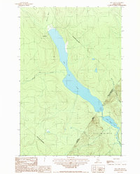
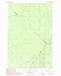
1987 Map of East Lake
USGS Topo · Published 1987About this map
The international boundary between Canada and the United States bisects this remote landscape, where the waters of Lac de l'Est cross from the Municipalité de Mont-Carmel in Quebec into Aroostook County, Maine. This 1987 provisional survey details a terrain defined by drainage patterns and international borders, notably where the lake transitions into East Lake and connects to Little East Lake. The hydrological network is the primary feature of the region, including the headwaters of the Chimenticook Stream and the winding Rivière des Pointes. Located within the township of T 17 R 14 Wels, the area shows no major settlements, instead highlighting the precise demarcation of the Quebec-Maine line and the various brooks, such as Pocwock Stream, that feed into this trans-border watershed.
Find a feature on this map
13 named features on this map. Tap any name to fly to it.
Don’t see what you’re looking for? This feature index may not catch every label — zoom into the map to look around manually.
Map Details
Editions of this 1987 East Lake Map
This is the sole edition of this map. No revisions or reprints were ever made.
Other maps of this area

1955 · Rocky Mountain
USGS Topo · 1:62,500

1955 · Little East Lake
USGS Topo · 1:62,500

1955 · Rocky Brook
USGS Topo · 1:62,500

1962 · Edmundston
USGS Topo · 1:250,000

1976 · East Lake
USGS Topo · 1:24,000

1976 · East Lake SE
USGS Topo · 1:24,000
1977 · St. Omer
USGS Topo · 1:24,000
1987 · Rocky Mountain SW
USGS Topo · 1:24,000
1987 · St. Omer
USGS Topo · 1:24,000
1987 · Morrison Brook
USGS Topo · 1:24,000