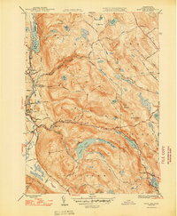
1948 Map of East Lee
USGS Topo · Published 1948About this map
The Housatonic River corridor serves as the industrial and transportation spine for this portion of the Berkshires in the late 1940s. While the valley floor supports the paper and textile centers of Lee, Lenoxdale, and East Lee, the surrounding highlands are defined by the expansive forests of October Mountain. The map illustrates a landscape in transition, where the New York New Haven and Hartford railroad follows the riverbank, contrasted by the emerging recreational value of the high country. The Appalachian Trail winds through the eastern ridges, passing Finerty Pond and Becket Mountain, reflecting the area's dual identity as a manufacturing hub and a wilderness destination. Significant water bodies like Upper Goose Pond and Greenwater Pond are framed by a network of early rural routes, including the well-known Jacobs Ladder Road and Washington Mountain Road.
Find a feature on this map
59 named features on this map. Tap any name to fly to it.
Don’t see what you’re looking for? This feature index may not catch every label — zoom into the map to look around manually.
Map Details
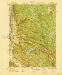
Editions of this 1948 East Lee Map
2 editions found
Other maps of this area

1885 · Sheffield
USGS Topo · 1:62,500

1886 · Becket
USGS Topo · 1:62,500

1888 · Sheffield
USGS Topo · 1:62,500

1888 · Becket
USGS Topo · 1:62,500

1888 · Sandisfield
USGS Topo · 1:62,500

1888 · Pittsfield
USGS Topo · 1:62,500

1890 · Pittsfield
USGS Topo · 1:62,500

1891 · Sheffield
USGS Topo · 1:62,500

1893 · Becket
USGS Topo · 1:62,500

1893 · Sheffield
USGS Topo · 1:62,500