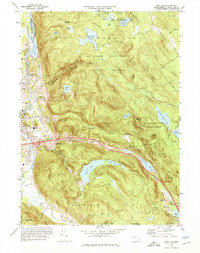
1973 Map of East Lee
USGS Topo · Published 1974About this map
October Mountain State Forest dominates the interior of this 1970s survey, a landscape defined by its high-altitude water bodies and the winding course of the Housatonic River. The river valley serves as the primary corridor for transportation and industry, carrying the Penn Central tracks and hosting the settlements of Lenox Dale and Lee. The era's modern infrastructure is represented by the Massachusetts Toll Turnpike and its Interchange 2, which cuts across the southern portion of the quadrangle near East Lee.
Find a feature on this map
52 named features on this map. Tap any name to fly to it.
Don’t see what you’re looking for? This feature index may not catch every label — zoom into the map to look around manually.
Map Details
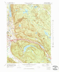
Editions of this 1973 East Lee Map
3 editions found

Other maps of this area

1885 · Sheffield
USGS Topo · 1:62,500

1886 · Becket
USGS Topo · 1:62,500

1888 · Sheffield
USGS Topo · 1:62,500

1888 · Becket
USGS Topo · 1:62,500

1888 · Sandisfield
USGS Topo · 1:62,500

1888 · Pittsfield
USGS Topo · 1:62,500

1890 · Pittsfield
USGS Topo · 1:62,500

1891 · Sheffield
USGS Topo · 1:62,500

1893 · Becket
USGS Topo · 1:62,500

1893 · Sheffield
USGS Topo · 1:62,500