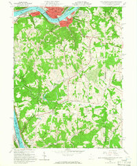
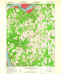
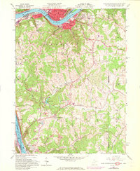
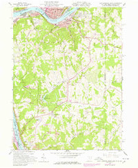
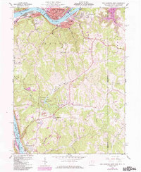
1960 Map of East Liverpool South
USGS Topo · Published 1965About this map
Industrial activity and river transport define this 1960 survey of the northern panhandle, where the Ohio River forms a busy corridor between West Virginia, Ohio, and Pennsylvania. Large-scale manufacturing and shipping facilities dominate the riverbanks at Newell, Chester, and New Cumberland, while the Pennsylvania railroad tracks trace the water’s edge to serve the valley’s heavy industry. The New Cumberland Lock and Dam stands as a massive piece of infrastructure regulating the flow of the river during this era of post-war growth.
Find a feature on this map
54 named features on this map. Tap any name to fly to it.
Don’t see what you’re looking for? This feature index may not catch every label — zoom into the map to look around manually.
Map Details
Editions of this 1960 East Liverpool South Map
6 editions found
Historical Maps of East Liverpool Through Time
No other maps found