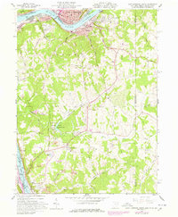
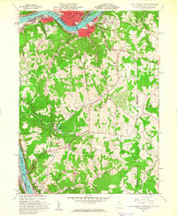
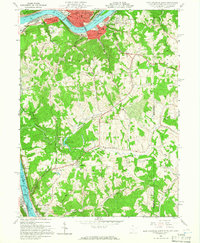
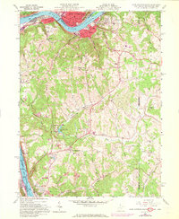
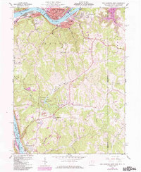
1960 Map of East Liverpool South
USGS Topo · Published 1978About this map
The Ohio River carves a path through this industrial and rural landscape, separating the manufacturing centers of East Liverpool, Ohio, from the river towns of Chester and Newell, West Virginia. The river's influence is evident in the dense rail infrastructure of the Penn Central and the strategic positioning of the Pumping Sta on the West Virginia bank. Beyond the river corridor, the terrain shifts into the wooded hills and hollows of Grant and Hanover districts, where local life centered around rural landmarks like the Emmanuel Mission Ch and the Locust Hill Cem.
Find a feature on this map
51 named features on this map. Tap any name to fly to it.
Don’t see what you’re looking for? This feature index may not catch every label — zoom into the map to look around manually.
Map Details
Editions of this 1960 East Liverpool South Map
6 editions found
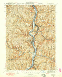
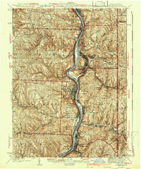
Other maps of this area

1901 · Beaver
USGS Topo · 1:62,500

1904 · Wellsville
USGS Topo · 1:62,500

1904 · Steubenville
USGS Topo · 1:62,500

1904 · Beaver
USGS Topo · 1:62,500

1904 · Burgettstown
USGS Topo · 1:62,500

1906 · Burgettstown
USGS Topo · 1:62,500
1935 · Steubenville
USGS Topo · 1:62,500

1937 · Wellsville
USGS Topo · 1:62,500
1942 · Steubenville
USGS Topo · 1:62,500

1944 · Wellsville
USGS Topo · 1:62,500