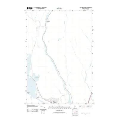
2011 Map of East Millinocket
USGS Topo · Published 2011About this map
East Millinocket and its surrounding river landscape define this survey, situated at the confluence where the West Branch Penobscot River meets the larger waterway. The local economy and geography are anchored by the industrial and hydrological development of the river system, most notably at the Dolby Dam which creates the expansive Dolby Pond. Further north, the settlement of Grindstone sits near the Grindstone Falls on the East Branch Penobscot River, marking a transition toward more wilderness-dominated terrain. The map details the local infrastructure of the early 21st century, including the East Millinocket Post Office and a network of arterial roads like Schoodic Rd and Madden Rd. This area is characterized by a complex network of tributaries such as Tots Brook and Salmon Stream that feed the Penobscot watershed.
Find a feature on this map
24 named features on this map. Tap any name to fly to it.
Don’t see what you’re looking for? This feature index may not catch every label — zoom into the map to look around manually.
Map Details
Editions of this 2011 East Millinocket Map
This is the sole edition of this map. No revisions or reprints were ever made.
Other maps of this area

1940 · Sherman
USGS Topo · 1:62,500

1940 · Mattawamkeag
USGS Topo · 1:62,500

1942 · Mattawamkeag
USGS Topo · 1:62,500

1942 · Sherman
USGS Topo · 1:62,500

1951 · Millinocket
USGS Topo · 1:62,500

1953 · Stacyville
USGS Topo · 1:62,500

1954 · Millinocket
USGS Topo · 1:250,000

1958 · Millinocket
USGS Topo · 1:250,000

1960 · Millinocket
USGS Topo · 1:250,000

1975 · Millinocket SW
USGS Topo · 1:24,000