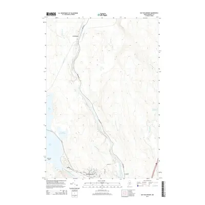
2014 Map of East Millinocket
USGS Topo · Published 2014About this map
East Millinocket serves as the primary hub of this northern Maine landscape, where the confluence of the West Branch Penobscot River and the East Branch Penobscot River shapes the local geography. The town's grid, featuring streets named for native trees like Cedar St and Birch St, sits just below the industrial presence at Dolby. Water dominates the western half of the map, characterized by the expansive Dolby Pond and the Partridge Brook Flowage. To the north, the settlement of Grindstone is situated along the river, near several significant whitewater features including Meadow Brook Rapids and Grindstone Falls. This area reveals a classic Maine timber and river-driven economy, with Grindstone Rd providing the primary corridor through a landscape dotted with deadwaters and streams like Wadleigh Deadwater and Salmon Stream.
Find a feature on this map
34 named features on this map. Tap any name to fly to it.
Don’t see what you’re looking for? This feature index may not catch every label — zoom into the map to look around manually.
Map Details
Editions of this 2014 East Millinocket Map
This is the sole edition of this map. No revisions or reprints were ever made.
Other maps of this area

1940 · Sherman
USGS Topo · 1:62,500

1940 · Mattawamkeag
USGS Topo · 1:62,500

1942 · Mattawamkeag
USGS Topo · 1:62,500

1942 · Sherman
USGS Topo · 1:62,500

1951 · Millinocket
USGS Topo · 1:62,500

1953 · Stacyville
USGS Topo · 1:62,500

1954 · Millinocket
USGS Topo · 1:250,000

1958 · Millinocket
USGS Topo · 1:250,000

1960 · Millinocket
USGS Topo · 1:250,000

1975 · Millinocket SW
USGS Topo · 1:24,000