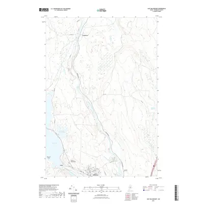
2021 Map of East Millinocket
USGS Topo · Published 2021About this map
The confluence of the West Branch Penobscot River and the East Branch defines the industrial and natural character of this Penobscot County landscape. In the southern portion of the map, the settlement of East Millinocket is densely gridded with streets such as Maple St and North St, anchored by the Katahdin Regional Higher Education Center and neighboring industrial zones. This area contrasts sharply with the northern reaches, where the river winds through a series of dramatic water features including Grindstone Falls and Meadow Brook Rapids. The importance of the waterway to the region's development is evident in the presence of the Dolby settlement near Dolby Pond and the Partridge Brook Flowage. Further north, the small community of Grindstone sits along the riverbanks, served by the long stretch of Grindstone Rd and the nearby Grindstone Road Cem.
Find a feature on this map
46 named features on this map. Tap any name to fly to it.
Don’t see what you’re looking for? This feature index may not catch every label — zoom into the map to look around manually.
Map Details
Editions of this 2021 East Millinocket Map
This is the sole edition of this map. No revisions or reprints were ever made.
Other maps of this area

1940 · Sherman
USGS Topo · 1:62,500

1940 · Mattawamkeag
USGS Topo · 1:62,500

1942 · Mattawamkeag
USGS Topo · 1:62,500

1942 · Sherman
USGS Topo · 1:62,500

1951 · Millinocket
USGS Topo · 1:62,500

1953 · Stacyville
USGS Topo · 1:62,500

1954 · Millinocket
USGS Topo · 1:250,000

1958 · Millinocket
USGS Topo · 1:250,000

1960 · Millinocket
USGS Topo · 1:250,000

1975 · Millinocket SW
USGS Topo · 1:24,000