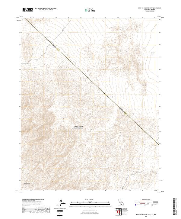
2021 Map of East of Chloride City
USGS Topo · Published 2021About this map
The Funeral Mountains dominate this arid landscape along the high-desert border of California and Nevada. Within the boundaries of Death Valley National Park, the terrain transitions from the high peaks of the Death Valley Amargosa Range into the broad expanse of the Mojave Desert. The map documents a sparsely developed region where the rugged topography is the primary feature, accessed only by remote tracks such as Chloride Cliff Rd. To the northeast, the land levels out into the Amargosa Desert, marking a stark contrast to the complex ridgelines and canyons of the mountains. This 2021 survey provides a contemporary view of the protected wilderness areas and the precise state line dividing Inyo County from Nye County.
Find a feature on this map
14 named features on this map. Tap any name to fly to it.
Don’t see what you’re looking for? This feature index may not catch every label — zoom into the map to look around manually.
Map Details
Editions of this 2021 East of Chloride City Map
This is the sole edition of this map. No revisions or reprints were ever made.
Other maps of this area

1908 · Furnace Creek
USGS Topo · 1:250,000

1910 · Furnace Creek
USGS Topo · 1:250,000

1942 · Bullfrog
USGS Topo · 1:125,000

1948 · Death Valley
USGS Topo · 1:250,000

1952 · Chloride Cliff
USGS Topo · 1:50,000

1952 · Big Dune
USGS Topo · 1:62,500

1954 · Bare Mtn
USGS Topo · 1:62,500

1954 · Bullfrog
USGS Topo · 1:62,500

1954 · Death Valley
USGS Topo · 1:250,000

1956 · Death Valley
USGS Topo · 1:250,000