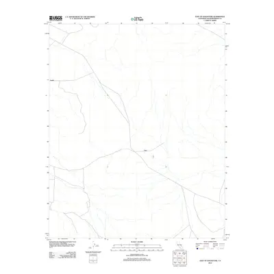
2012 Map of East of Goldstone
USGS Topo · Published 2012About this map
The high desert landscape of Apollo and Echo is defined by an intricate network of ephemeral washes and service tracks in this 2012 study of San Bernardino County. Located east of Goldstone, the terrain is characterized by broad alluvial systems that drain through the arid flats, punctuated by the sparse infrastructure typical of this remote California region. The map reveals the logistical layout of the area, showing how the primary routes intersect at Apollo in the west and Echo further east, serving as key navigational points amidst the complex topography of desert drainage and low-lying landforms. It offers a clear look at the spatial relationship between these named locations and the natural geography of the Mojave interior just after the first decade of the millennium.
Find a feature on this map
2 named features on this map. Tap any name to fly to it.
Don’t see what you’re looking for? This feature index may not catch every label — zoom into the map to look around manually.
Map Details
Editions of this 2012 East of Goldstone Map
This is the sole edition of this map. No revisions or reprints were ever made.
Other maps of this area

1933 · Avawatz Mountains
USGS Topo · 1:250,000

1947 · Trona
USGS Topo · 1:250,000

1948 · Trona
USGS Topo · 1:250,000

1948 · Alvord Mountain
USGS Topo · 1:62,500

1948 · Lane Mountain
USGS Topo · 1:62,500

1948 · Goldstone Lake
USGS Topo · 1:62,500

1948 · Tiefort Mountains
USGS Topo · 1:62,500

1951 · Goldstone Lake
USGS Topo · 1:62,500

1951 · Tiefort Mountains
USGS Topo · 1:62,500

1951 · Alvord Mountain
USGS Topo · 1:62,500