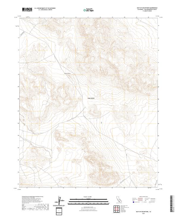
2021 Map of East of Goldstone
USGS Topo · Published 2021About this map
The Mojave Desert terrain defines this high-desert region, where modern technological infrastructure meets the geometric lines of the Public Land Survey System. The map documents a landscape oriented around specialized scientific and aerospace access, dominated by the Presence of Nasa and its supporting roadways. Development is concentrated along corridors like Goldstone Rd and Venus Station Rd, which link remote technical sites. Unlike typical residential or agricultural maps, this survey reveals an arid expanse utilized for deep-space communication and observation, indicated by labels like Gemini Station. The gridded township lines, including t14n r1e and t14n r2e, provide the underlying structure for these isolated desert installations.
Find a feature on this map
10 named features on this map. Tap any name to fly to it.
Don’t see what you’re looking for? This feature index may not catch every label — zoom into the map to look around manually.
Map Details
Editions of this 2021 East of Goldstone Map
This is the sole edition of this map. No revisions or reprints were ever made.
Other maps of this area

1933 · Avawatz Mountains
USGS Topo · 1:250,000

1947 · Trona
USGS Topo · 1:250,000

1948 · Trona
USGS Topo · 1:250,000

1948 · Alvord Mountain
USGS Topo · 1:62,500

1948 · Lane Mountain
USGS Topo · 1:62,500

1948 · Goldstone Lake
USGS Topo · 1:62,500

1948 · Tiefort Mountains
USGS Topo · 1:62,500

1951 · Goldstone Lake
USGS Topo · 1:62,500

1951 · Tiefort Mountains
USGS Topo · 1:62,500

1951 · Alvord Mountain
USGS Topo · 1:62,500