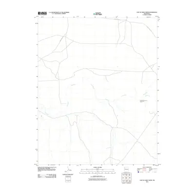
2010 Map of East of Great Bend
USGS Topo · Published 2010About this map
The Chaco River meanders across this high desert landscape within the Shiprock Agency region, defining the drainage patterns of an area marked by deep cultural history. One of the most significant designations on this map is the Great Bend Community Archaeological District, which highlights the preservation of ancient sites along the river's bend. The network of Indian Service Rte roads provides the primary access through this arid terrain, linking the scattered homesteads and seasonal watercourses. Smaller tributaries like Indian Creek feed into the main river channel, illustrating the critical role of water in this expansive New Mexico environment during the early 21st century.
Find a feature on this map
4 named features on this map. Tap any name to fly to it.
Don’t see what you’re looking for? This feature index may not catch every label — zoom into the map to look around manually.
Map Details
Editions of this 2010 East of Great Bend Map
This is the sole edition of this map. No revisions or reprints were ever made.
Other maps of this area

1889 · Chaco
USGS Topo · 1:250,000

1892 · Chaco
USGS Topo · 1:250,000

1927 · Sulphur Spring
USGS Topo · 1:96,000

1928 · Kirtland
USGS Topo · 1:125,000

1932 · Kirtland
USGS Topo · 1:125,000

1954 · Shiprock
USGS Topo · 1:250,000

1958 · Shiprock
USGS Topo · 1:250,000

1959 · Shiprock
USGS Topo · 1:250,000
1966 · Burnham Trading Post
USGS Topo · 1:24,000
1966 · The Pillar 3 NE
USGS Topo · 1:24,000