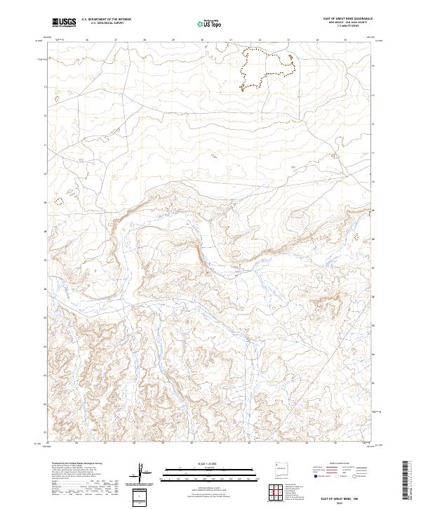
2023 Map of East of Great Bend
USGS Topo · Published 2023About this map
Chaco River carves a winding path through this corner of San Juan County, defining the drainage patterns of an arid landscape in the high desert of northwestern New Mexico. This 2023 survey illustrates the complex topography of the region, where the river meets Indian Creek amidst a network of canyons and plateaus. The map is primarily organized by the Public Land Survey System, showing the intersections of townships T23N R15W and T22N R15W. While the area lacks dense modern settlements, the detailed contouring reveals the natural landforms and ephemeral watercourses that have dictated movement and land use in this part of the Navajo Nation for generations.
Find a feature on this map
8 named features on this map. Tap any name to fly to it.
Don’t see what you’re looking for? This feature index may not catch every label — zoom into the map to look around manually.
Map Details
Editions of this 2023 East of Great Bend Map
This is the sole edition of this map. No revisions or reprints were ever made.
Other maps of this area

1889 · Chaco
USGS Topo · 1:250,000

1892 · Chaco
USGS Topo · 1:250,000

1927 · Sulphur Spring
USGS Topo · 1:96,000

1928 · Kirtland
USGS Topo · 1:125,000

1932 · Kirtland
USGS Topo · 1:125,000

1954 · Shiprock
USGS Topo · 1:250,000

1958 · Shiprock
USGS Topo · 1:250,000

1959 · Shiprock
USGS Topo · 1:250,000
1966 · Burnham Trading Post
USGS Topo · 1:24,000
1966 · The Pillar 3 NE
USGS Topo · 1:24,000