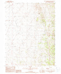
1990 Map of East of Pancake Summit
USGS Topo · Published 1990About this map
Newark Valley dominates the western half of this Nevada landscape, transitioning into the elevated terrain of the White Pine Range to the east. This 1990 provisional survey documents a sparse high-desert environment where water sources like White Hill Spring were critical waypoints. Human activity is evidenced primarily by resource extraction and infrastructure, with several Gravel Pits and a noted Prospect situated near the foothills of Antelope Mountain. A prominent Transmission Line cuts across the northern basin, marking the modern utility corridor through this traditional rangeland. The map provides a look at the sectioned boundaries of Townships 17, 18, and 19 North, capturing the geometric overlay of public land surveys on the basin-and-range topography.
Find a feature on this map
11 named features on this map. Tap any name to fly to it.
Don’t see what you’re looking for? This feature index may not catch every label — zoom into the map to look around manually.
Map Details
Editions of this 1990 East of Pancake Summit Map
This is the sole edition of this map. No revisions or reprints were ever made.
Other maps of this area

1951 · Illipah
USGS Topo · 1:62,500

1951 · Pancake Summit
USGS Topo · 1:62,500

1956 · Ely
USGS Topo · 1:250,000

1957 · Buck Mountain
USGS Topo · 1:62,500

1959 · Ely
USGS Topo · 1:250,000

1963 · Ely
USGS Topo · 1:250,000

1979 · Mt. Hamilton
USGS Topo · 1:100,000

1982 · Sunshine Well
USGS Topo · 1:24,000

1985 · Newark Lake
USGS Topo · 1:100,000

1990 · Pancake Summit SW
USGS Topo · 1:24,000