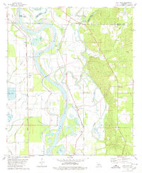
1979 Map of East Point
USGS Topo · Published 1980About this map
The Red River creates a meandering path through this Red River Parish landscape, defining the boundaries and agricultural patterns of the late 1970s. The riverside economy is marked by several aquaculture operations, including a Fish Farm near Coushatta Bayou and others near Williams and Halls Slough. Transport and logistics are anchored by two major rail lines: the Kansas City Southern running north-south through East Point and New Hope, and the Missouri Pacific serving western settlements like Westdale and Howard.
Find a feature on this map
49 named features on this map. Tap any name to fly to it.
Don’t see what you’re looking for? This feature index may not catch every label — zoom into the map to look around manually.
Map Details
Editions of this 1979 East Point Map
This is the sole edition of this map. No revisions or reprints were ever made.
Other maps of this area

1941 · East Point
USGS Topo · 1:31,680

1941 · Bossier Point
USGS Topo · 1:31,680

1945 · Mansfield
USGS Topo · 1:62,500

1947 · Ringgold
USGS Topo · 1:62,500

1947 · Mansfield
USGS Topo · 1:62,500

1948 · Coushatta
USGS Topo · 1:62,500

1948 · Caspiana
USGS Topo · 1:62,500

1955 · Shreveport
USGS Topo · 1:250,000

1955 · Caspiana
USGS Topo · 1:62,500

1956 · Shreveport
USGS Topo · 1:250,000