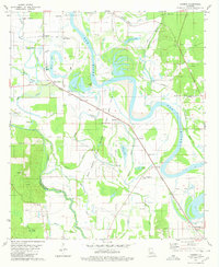
1980 Map of Harmon
USGS Topo · Published 1980About this map
The Red River dominates this portion of northern Louisiana, creating a complex landscape of oxbows and backwaters like Wilson Lake, Beard Lake, and Lee Lake. Along the meandering channel, The Cutoff marks a significant shift in the river's course, surrounded by the extensive Gas Field that defines the local extraction economy. The geography is punctuated by small rural settlements and religious centers such as Abington, Magnolia, and Armistead, many of which grew alongside the Kansas City Southern and Missouri Pacific railroads.
Find a feature on this map
60 named features on this map. Tap any name to fly to it.
Don’t see what you’re looking for? This feature index may not catch every label — zoom into the map to look around manually.
Map Details
Editions of this 1980 Harmon Map
This is the sole edition of this map. No revisions or reprints were ever made.
Other maps of this area

1938 · Chemard Lake
USGS Topo · 1:31,680

1938 · Lake End
USGS Topo · 1:31,680

1941 · East Point
USGS Topo · 1:31,680

1941 · Pelican
USGS Topo · 1:62,500

1943 · Pleasant Hill
USGS Topo · 1:62,500

1944 · Pleasant Hill
USGS Topo · 1:62,500

1945 · Mansfield
USGS Topo · 1:62,500

1947 · Mansfield
USGS Topo · 1:62,500

1947 · Hanna
USGS Topo · 1:62,500

1948 · Coushatta
USGS Topo · 1:62,500