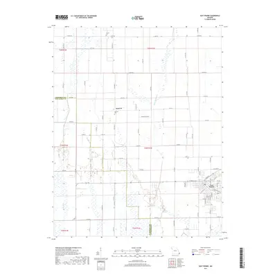
2017 Map of East Prairie
USGS Topo · Published 2017About this map
The town of East Prairie serves as the primary hub in this low-lying agricultural landscape of Southeast Missouri. Located in the Bootheel region, the area is defined by a sophisticated network of drainage infrastructure, such as Maple Slough Ditch and Ash Ditch, which reclaimed the fertile soils of Dogwood Bottoms for cultivation. This 2017 survey illustrates the persistent importance of the section-line road system, where routes like State Hwy B and State Hwy C connect dispersed rural communities. Smaller settlements such as Dogwood are preserved here alongside vital genealogical landmarks, including Dogwood Cem and Armour Cem. The boundary between Mississippi Co and New Madrid Co cuts through the western portion of the sheet, highlighting the jurisdictional divide in this heavily engineered alluvial plain.
Find a feature on this map
80 named features on this map. Tap any name to fly to it.
Don’t see what you’re looking for? This feature index may not catch every label — zoom into the map to look around manually.
Map Details
Editions of this 2017 East Prairie Map
This is the sole edition of this map. No revisions or reprints were ever made.
Other maps of this area

1931 · Sikeston
USGS Topo · 1:62,500

1934 · Sikeston
USGS Topo · 1:62,500

1939 · Sikeston
USGS Topo · 1:62,500

1939 · Charleston
USGS Topo · 1:62,500

1939 · New Madrid
USGS Topo · 1:62,500

1939 · Bayouville
USGS Topo · 1:62,500

1954 · Charleston
USGS Topo · 1:62,500

1954 · New Madrid
USGS Topo · 1:62,500

1955 · Bayouville
USGS Topo · 1:62,500

1956 · Dyersburg
USGS Topo · 1:250,000