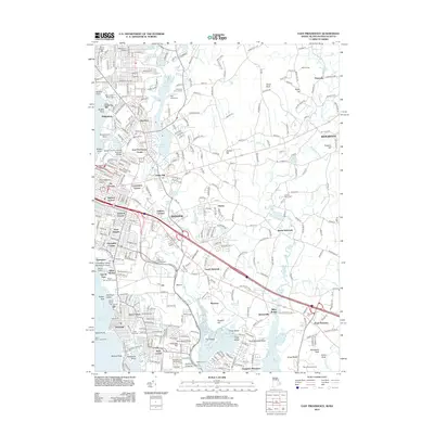
2012 Map of East Providence
USGS Topo · Published 2012About this map
The Ten Mile River and Runnins River carve through this landscape at the border of Rhode Island and Massachusetts, anchoring a network of reservoirs and tidal inlets. Coastal landmarks like Sabin Point Lighthouse and the Pomham Rocks Light House overlook the Providence River, marking the maritime approach to the city. The area is defined by a high concentration of memorial grounds, including Mount Saint Marys Cem and the Gate of Heaven Cem, which serve as significant sites for genealogical research. Residential expansion is evident in neighborhoods like Rumford, Riverside, and Hampden Meadows, while the Boston and Providence Railroad Bridge represents the region's enduring transit infrastructure. From the athletic grounds of McCoy Stadium to the institutional campus of Barrington College, this map captures the mid-century suburban and industrial character of the East Bay region.
Find a feature on this map
105 named features on this map. Tap any name to fly to it.
Don’t see what you’re looking for? This feature index may not catch every label — zoom into the map to look around manually.
Map Details
Editions of this 2012 East Providence Map
This is the sole edition of this map. No revisions or reprints were ever made.
Other maps of this area

1885 · Taunton
USGS Topo · 1:62,500

1887 · Providence
USGS Topo · 1:62,500

1888 · Fall River
USGS Topo · 1:62,500

1888 · Taunton
USGS Topo · 1:62,500

1889 · Providence
USGS Topo · 1:62,500

1890 · Narragansett Bay
USGS Topo · 1:62,500

1892 · Narragansett Bay
USGS Topo · 1:62,500

1893 · Taunton
USGS Topo · 1:62,500

1893 · Fall River
USGS Topo · 1:62,500

1894 · Providence
USGS Topo · 1:62,500