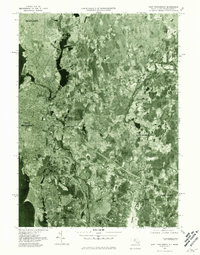
1977 Map of East Providence
USGS Topo · Published 1981About this map
East Providence and the surrounding borderlands of Rhode Island and Massachusetts appear here in a series of aerial captures from the late 1970s. This orthophotograph, prepared from imagery taken in April 1977, provides a direct visual record of the region's suburban development and remaining open tracts before the intensification of the late twentieth century. The map centers on the winding course of the Ten Mile River and the broader reaches of the Seekonk River, which separate the dense urban grid of Pawtucket and East Providence from the more dispersed settlements to the east.
Find a feature on this map
12 named features on this map. Tap any name to fly to it.
Don’t see what you’re looking for? This feature index may not catch every label — zoom into the map to look around manually.
Map Details
Editions of this 1977 East Providence Map
This is the sole edition of this map. No revisions or reprints were ever made.
Other maps of this area

1885 · Taunton
USGS Topo · 1:62,500

1887 · Providence
USGS Topo · 1:62,500

1888 · Fall River
USGS Topo · 1:62,500

1888 · Taunton
USGS Topo · 1:62,500

1889 · Providence
USGS Topo · 1:62,500

1890 · Narragansett Bay
USGS Topo · 1:62,500

1892 · Narragansett Bay
USGS Topo · 1:62,500

1893 · Taunton
USGS Topo · 1:62,500

1893 · Fall River
USGS Topo · 1:62,500

1894 · Providence
USGS Topo · 1:62,500