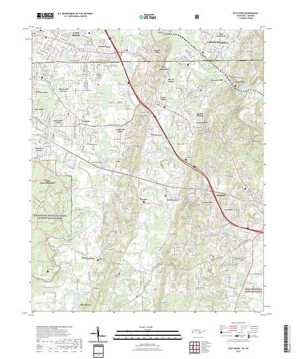
2022 Map of East Ridge
USGS Topo · Published 2022About this map
The Chickamauga and Chattanooga National Military Park and its surrounding terrain anchor this 2022 survey of the Tennessee-Georgia borderlands. The landscape transitions from the residential developments of East Ridge and Fort Oglethorpe into the wooded ridges and creek valleys of Catoosa County. This contemporary record preserves the locations of numerous historic burial grounds, including Newman Springs Cem, Boynton Cem, and Burning Bush Cem, which sit alongside newer neighborhoods like Cinderella Hills and Morris Estates. The complex hydrography of West Chickamauga Creek and its many tributaries, such as Hurricane Br and Peavine Cr, illustrates the geographical features that have long dictated the region's transport routes and settlement patterns. Further south, the map reaches into the Chattahoochee National Forest, documenting the intersection of modern infrastructure like Battlefield Pkwy with natural landmarks such as The Backbone.
Find a feature on this map
68 named features on this map. Tap any name to fly to it.
Don’t see what you’re looking for? This feature index may not catch every label — zoom into the map to look around manually.
Map Details
Editions of this 2022 East Ridge Map
This is the sole edition of this map. No revisions or reprints were ever made.
Other maps of this area

1886 · Ringgold
USGS Topo · 1:125,000

1888 · Chattanooga
USGS Topo · 1:125,000

1892 · Ringgold
USGS Topo · 1:125,000

1893 · Chattanooga
USGS Topo · 1:125,000

1935 · East Chattanooga
USGS Topo · 1:24,000

1935 · East Ridge
USGS Topo · 1:24,000

1935 · Ringgold
USGS Topo · 1:24,000

1935 · Nickajack Gap
USGS Topo · 1:24,000

1935 · Ooltewah
USGS Topo · 1:24,000

1935 · Tunnel Hill
USGS Topo · 1:24,000