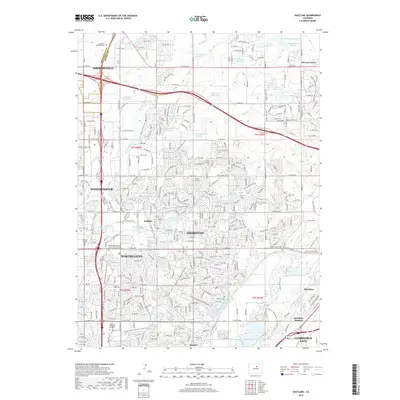
2019 Map of Eastlake
USGS Topo · Published 2019About this map
Thornton and its neighboring municipalities of Northglenn, Westminster, and Broomfield dominate this suburban landscape at the edge of the Denver metro area. The map reveals an intricate network of water management and recreational infrastructure, characterized by numerous numbered basins like Wadley Reservoir Number 1 and Eastlake Reservoir Number 1. Historical roots are still visible in the established community of Eastlake and the Wesley Chapel Cem, which sit alongside modern developments like the Metropolitan State University of Denver Metro North Campus. To the east, the terrain transitions toward the South Platte River valley, where settlements such as Hazeltine and Hazeltine Heights reflect the area's agricultural and industrial heritage. A vast system of recreational paths, including the Big Dry Creek Trail and S Platte River Trail, follows the historical alignment of irrigation features like the Farmers High Line Canal.
Find a feature on this map
74 named features on this map. Tap any name to fly to it.
Don’t see what you’re looking for? This feature index may not catch every label — zoom into the map to look around manually.
Map Details
Editions of this 2019 Eastlake Map
This is the sole edition of this map. No revisions or reprints were ever made.
Other maps of this area

1890 · East Denver
USGS Topo · 1:125,000

1899 · West Denver
USGS Topo · 1:125,000

1902 · Greeley
USGS Topo · 1:125,000

1904 · Niwot
USGS Topo · 1:62,500

1938 · Derby
USGS Topo · 1:24,000

1938 · Long Branch
USGS Topo · 1:24,000

1940 · Brighton
USGS Topo · 1:31,680

1940 · Eastlake
USGS Topo · 1:31,680

1940 · Lafayette
USGS Topo · 1:31,680

1940 · Derby
USGS Topo · 1:31,680