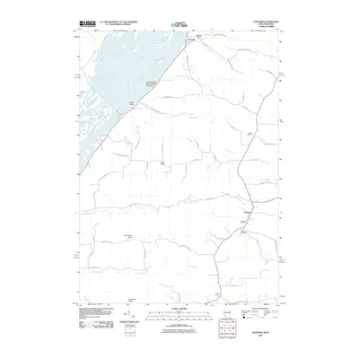
2010 Map of Eastman
USGS Topo · Published 2010About this map
The Mississippi River defines the western edge of this Crawford County landscape, where the braided channels of the river meet the high bluffs and deep coulees of the Driftless Area. High on these ridges, the village of Eastman serves as a central hub, connected by a network of ridge-top roads such as Ducharme Ridge Rd and Wall Ridge Rd. The map documents a significant genealogical landscape, featuring the National Cemetery and Saint Wencelaus Cemetery south of the main settlement.
Find a feature on this map
53 named features on this map. Tap any name to fly to it.
Don’t see what you’re looking for? This feature index may not catch every label — zoom into the map to look around manually.
Map Details
Editions of this 2010 Eastman Map
This is the sole edition of this map. No revisions or reprints were ever made.
Other maps of this area

1903 · Waukon
USGS Topo · 1:125,000

1924 · Gays Mills
USGS Topo · 1:62,500

1926 · Gays Mills
USGS Topo · 1:62,500

1926 · Wauzeka
USGS Topo · 1:62,500

1929 · Ferryville
USGS Topo · 1:62,500

1929 · Prairie Du Chien
USGS Topo · 1:62,500

1932 · Ferryville
USGS Topo · 1:62,500

1932 · Prairie Du Chien
USGS Topo · 1:62,500

1958 · La Crosse
USGS Topo · 1:250,000

1961 · La Crosse
USGS Topo · 1:250,000