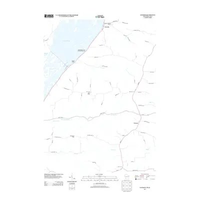
2013 Map of Eastman
USGS Topo · Published 2013About this map
Mississippi River frontage and high ridge systems define this portion of Crawford County as it appeared in the early 21st century. The river landscape is a complex of side channels and backwaters, including Saint Paul Slough and Shulz Crossing Slough, which frame the prominent Island Number One Hundred Fifty-nine. Inland, the terrain rises sharply into a series of named ridges and hollows that dictate the local road network. Settlements like Lynxville along the river and Eastman on the higher ground serve as local hubs, connected by routes like Wall Ridge Rd and Ducharme Ridge Rd. The map illustrates the agricultural and topographical transition from the river valley to the upland plateaus, where Hazen Corners and various hollows like Mezera Hollow and Leitner Hollow mark the deeply etched Coulee Country geography.
Find a feature on this map
55 named features on this map. Tap any name to fly to it.
Don’t see what you’re looking for? This feature index may not catch every label — zoom into the map to look around manually.
Map Details
Editions of this 2013 Eastman Map
This is the sole edition of this map. No revisions or reprints were ever made.
Other maps of this area

1903 · Waukon
USGS Topo · 1:125,000

1924 · Gays Mills
USGS Topo · 1:62,500

1926 · Gays Mills
USGS Topo · 1:62,500

1926 · Wauzeka
USGS Topo · 1:62,500

1929 · Ferryville
USGS Topo · 1:62,500

1929 · Prairie Du Chien
USGS Topo · 1:62,500

1932 · Ferryville
USGS Topo · 1:62,500

1932 · Prairie Du Chien
USGS Topo · 1:62,500

1958 · La Crosse
USGS Topo · 1:250,000

1961 · La Crosse
USGS Topo · 1:250,000