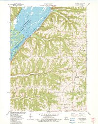
1983 Map of Eastman
USGS Topo · Published 1983About this map
Mississippi River backwaters and the high bluffs of Crawford County define this topographic survey, where the river's edge is a complex network of islands and sloughs like St Paul Slough and Gordons Bay. Two major rail lines, the Chicago Milwaukee St Paul and Pacific and the Burlington Northern, trace the narrow corridor between the water and the rising terrain. On the heights, the settlement of Eastman sits at a junction near St Wenceslaus Ch and a National Cem.
Find a feature on this map
45 named features on this map. Tap any name to fly to it.
Don’t see what you’re looking for? This feature index may not catch every label — zoom into the map to look around manually.
Map Details
Editions of this 1983 Eastman Map
This is the sole edition of this map. No revisions or reprints were ever made.
Other maps of this area

1903 · Waukon
USGS Topo · 1:125,000

1924 · Gays Mills
USGS Topo · 1:62,500

1926 · Gays Mills
USGS Topo · 1:62,500

1926 · Wauzeka
USGS Topo · 1:62,500

1929 · Ferryville
USGS Topo · 1:62,500

1929 · Prairie Du Chien
USGS Topo · 1:62,500

1932 · Ferryville
USGS Topo · 1:62,500

1932 · Prairie Du Chien
USGS Topo · 1:62,500

1958 · La Crosse
USGS Topo · 1:250,000

1961 · La Crosse
USGS Topo · 1:250,000